Overview
Length: 68.8
Climbing:4,200
Rating: 5.5
Climbing:Per Miles: 60 Ft.
Min./Max. Altitude: 1515 / 2214
This ride is a combination of the Bozoo Loop and the Wikel Loops using state route 122 as a short connector. Plenty of climbing rewarded with great vistas, and some flat sections along Indian and Hans Creek to give your legs some recovery time. The climb up to Wikel is the real climbing challenge of the ride but you have several miles of downhill and flat riding for recovery.. Turn list and GPS files start from Forest Hill. Other convenient places to start would be Greenville and the Vo. Tech school just off of 219 on 219/17 South of Wikel.
Location
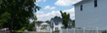
This ride is in Western Monroe, and Eastern Summers Counties. The nearest incorporated towns are Peterstown, Hinton and Alderson.
PDF Map and Turn List
Ride with GPS file of the route.
Directions to Forest Hill from Charleston, WV (PDF)
General Route Description
Start:
The route description as well as the pdf turn list starts in Forest Hill at the intersection of state route 12 and Co. 21/1, Seminole Road. At the intersection there is a church,and also another church 0.1 miles out Seminole Road where you can park.
Forest Hill to Red Sulphur Springs:
Heading South on route 12 for 0.2 miles you turn left on State Route 122 and dip down to Bradshaw Creek and then a couple short steep ramps up to the Summers, Monroe County line, where you take a right onto Co. 21.1. 21/1 is a narrow, single lane paved road that follows a ridge above Indian Creek for 1.9 miles, offering great vistas to the West and South before intersecting State Route 12. Taking a left on route 12, you have one of the great vistas of the state as you overlook the valley created by Indian Creek. You soon begin a two mile descent to the old resort village of Red Sulphur Springs. Caution:At the bottom of the descent the bridge across Indian Creek is in poor repair with rough expansion joints and surface.
Red Sulphur to Greenville:
After crossing the bridge, you take a left and an immediate left (170 degrees) onto Co. 23, Indian Mills Road. Co. 23 is another narrow road that follows along Indian Creek for a basically flat and shady 4 miles back to state route 122. Going right onto state route 122, you continue along the northern edge of the valley created by Indian Creek. At 12.8 miles, you will pass Co. 25. (Coming back, you will take a left and head up Hans Creek on Co. 25) and continue on route 122 to Greenville. As you climb into Greenville, there will be a convenience store on the left.
Greenville to Wikel:
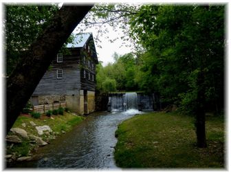
At the top of the hill, as you leave Greenville, you turn left at 16 miles onto Co. 23/4. Co. 23/4 offers the worst pavement of the ride with sections of very worn tar and chip, but makes up less than 5 miles of the route. At 19.6 miles you will pass thru the Lillydale Covered Bridge. Passing the bridge, you have an easy ascent, before a steep, twisting descent before arriving at the intersection with Co. 23/5. You make a very sharp right turn onto Co. 23/5 and are rewarded with good pavement and a gentle descent along Back Creek to state route 122 again. Take a left onto 122, you have a short climb and descent before taking a right onto Co. 23/7. You begin the real climbing challenge of the ride immediately after turning onto 23/7, but the lower part of the climb is fairly gentle, with some breaks, but the last 1/2 miles is a fairly consistent 10% grade up to Wikel.
Wikel to Hans Creek:
Topping the climb at Wikel, you continue straight at the intersection onto Co. 219/17. Enjoy the vista as you begin the descent down toward Hans Creek and U.S. 219. At about 29.7 miles, you pass the large public school and take a right and then another right at the old Coulter Chapel onto Co. 25. You can see U.S. 219, but you do not reach it. Co. 25 follows Hans Creek, but the paved road becomes Co. 25/4 where Hans Creek heads West. (This section of Co. 25 is abandoned.) You have an easy ascent out of Hans Creek and a descent back to Indian Creek along 25/4. There are one open grid, medal deck bridges on 25/4. At 35.9 you cross the the bridge behind Cooks Old Mill and go left on a short connector road to state route 122. (If you want to stop by the convenience store in Greenville again, you can continue straight and take the next left. ) At state route 122, you take a left and go about 2.8 miles before coming to the intersection with Co. 25 at 39.3 miles. At this intersection, you take a left and head up Hans Creek.
Hans Creek to Orchard:
Heading up Co. 25, you immediately cross an open grid, medal deck bridge, and begin a rolling ascent with great views along Hans Creek. At 42/4 miles, you cross Hans Creek and go left to continue on Co. 25. At mile 43.5 you cross another open grid, medal deck bridge and shortly, Co. 25, becomes 25/7, as Co. 25 goes left as a gravel road. 25/7 follows Blue Lick Creek and at mile 47.2 you begin a steep 0.4 mile climb up to Co. 27. At the top of the climb, you turn right onto Co. 27, and continue a more gradual ascent and then rolling ridge riding along Co. 27 until you reach Orchard.
Orchard to Bozoo:
At Orchard you take a left onto Co. 33 and ride along high ground with great vistas over to Ballard. At Ballard, you intersect state route 12 again at mile 53.6. There is a dairy bar at the intersection and a small convenience store on the right just after turning onto Co. 12. Turning left onto state route 12, you go 0.4 miles before turning right onto Co. 24 (Pinhook Rd.). This turn is on a descent. You will turn in front of the red roofed volunteer fire department building. Co. 24 is another narrow county road and features a lot of short climbs and one longer climb, just before arriving at Bozoo, but offers some great views. Arriving at Bozoo (56.7), there will be a church on the left at the four way intersection. At this intersection, you have the option of shortening the ride by 2.4 miles by taking a right onto Co. 24/2, which becomes Summers Co. 23/7.
Bozoo to Forest Hills:
At the intersection in Bozoo, you will continue straight onto Co. 24/3, Shanklins Ferry Road, which becomes Summers Co. 23/6, and will quickly have a great vista overlooking the New River drainage area. At the bottom of a steep descent, you bare right onto Co. 23.5, (straight takes you to a campground) and have a short steep climb. At 61.2, you climb up to the intersection with Co. 23/7 (shorter option mentioned above) and continue straight. At the bottom of the downhill is a blind sharp right turn that usually has gravel in it. A road goes straight here to another campground. You will now be on Co. 33/2 and follow Stinking Lick Creek to Indian Mills, where up pick up Indian Creek again. The next bridge over Indian Creek has a poor surfaces. From Indian Mills where the headquarters of the Bluestone Wildlife Management Area is located, you have rolling terrain out to state route 12 at mile 67. Taking a left on route 12, you begin a gradual climb, that gets steeper as you get closer to the finish at 68.8 miles in Forest Hills.
Local Sources
Nearest Bike Shops:
Hammer Cycles, White Sulphur Springs
Free Spirit Adventures, Caldwell, WV
Food - Water Sources: There are two stores along the route. One in Greenville and one in Ballard. Also a dairy bar at Ballard.


 1
1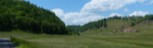 2
2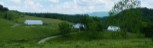 3
3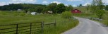 4
4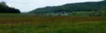 5
5 6
6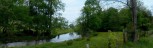 7
7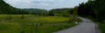 8
8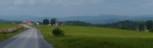 9
9 10
10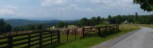 11
11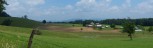 12
12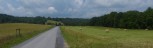 13
13