


 1
1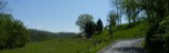 2
2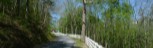 3
3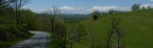 4
4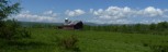 5
5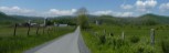 6
6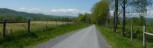 7
7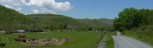 8
8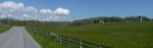 9
9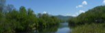 10
10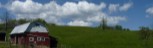 11
11 12
12 13
13General Route Description
This is a short route that follows the hills on both sides of the Greenbrier River. A quarter of the route follows state route 3 leaving and arriving in Alderson. The rest of the ride is on narrow low traffic roads.
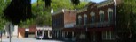
Alderson to Pence Springs: Parking along the river on state route 3 in Alderson, you cross the pedestrian bridge and continue South (straight) on state route 3. You begin a twisty climb as you leave Alderson, before a gentle downgrade and the junction of county 3/2. You take a right onto 3/2, that becomes 15/1 in Summers County. It is a narrow road and has a couple places where the pavement is far from ideal, but still passable. You have a couple of climbs on 15/1 before crossing back into Monroe County as CO. 7/1 and connecting with CO. 7. Taking a right on Co. 7 you have a short steep climb on CO. 7 which becomes CO. 15 in Summers County. You travel thru some pretty farm country and drop down to the Greenbrier River and bare right, continuing on CO. 15 into Pence Springs. The is a very pleasant, and fairly flat cruise in the Greenbrier Valley.
Pence Springs to Alderson.: Crossing the Greenbrier River on CO. 15, you come to the intersection with state routes3 - 12. There is a convenience store in sight up the road to the right from this intersection. This is the only source of public water and food on the route. However, you go left and make an immediate right onto CO. 3/18. This is a steep climb of 0.6 miles up to the junction with CO. 6. Taking a right (really straight) on county 6, you continue to climb, but on a much gentler grade along Right Hand Fork though the community of Clayton (more a place on a map, than a community.) where you continue straight onto CO. 7. Past Clayton, you will top out and cross over to the Griffith Fork drainage and begin the descent down to the Greenbrier River. At the river, you take a left onto State. 3 - 12 for a relatively flat ride back into Alderson. and the Finish. This section of road will have the most traffic on the route.
Food-Water Sources:
The only public food and water sources on the route, is the convenience store off to the right at the junction of CO. 15 and State 3 in Pence Springs. The route goes in the opposite direction.