


 1
1 2
2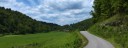 3
3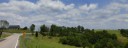 4
4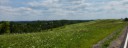 5
5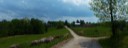 6
6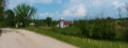 7
7General Description
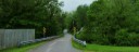
Start to Bibbie Ridge: Taking a left out of the parking lot, you take the next right onto route 21 which is a two lane striped road. Traffic is usually light, as I-77 takes most of the thru traffic. You head north on route 21 and pass under I-77 before arriving at the rural community of Goldtown. When you get to Goldtown, you will take a left on 21/37, Dog Fork Road. This is a narrow single lane paved road. Be ready to stop to let passing traffic (if you meet any) by. This follows Dog Fork up stream at a gentle incline for 4 miles before arriving at the first climbing challenge of the ride. This is a steep 0.4 mile climb up to Bibbee ridge that starts out at about 15 percent before settling down to 8-10 percent the remainder of the way.
Bibbie Ridge to Kenna: Arriving at the top of the climb on Dog Fork, you take a right on State 34, another two lane striped road. Bibbee Ridge is anything but flat with a couple big dips and climbs in it, before coming to the intersection with Rt. 21 again at Divide Hill. Taking a left on Rt. 21, you begin an immediate descent, and then a short flat stretch to Kenna. At Kenna, you take a right off of Rt. 21, but continuing to follow State 34. You continue straight on this road, passing under I-77 as the road continues to climb and there is a gas station on the right. This is the one source of drinks and snacks on the route. (Just past the store, Cty.19/4 goes right. This is a shorter, flatter, but rougher pavement route to the finish if your legs are feeling tired.)
Kenna to Finish: Leaving the store, you have a short steep ramp to finish the climb on what is now Co. 19 (state 34 terminates at the interstate) , and you bare right at the top. You have a short down hill, another short climb, one more short descent and climb before arriving at the intersection of county 19/9, Fishers Ridge Road. (This is where the Optional Route diverges from main route.) Taking a right on 19/9, you begin a few more miles of ridge riding across Fishers Ridge. There is new pavement (2018) the lenght of Fishers Ridge. Fishers Ridge has the same rolling terrain as Bibbee Ridge. At the end of Ridge, you begin the twisting descent of Fishers Ridge (watch your speed) that comes out on Co. 21. Take a left on Co. 21, you retrace your route for the last 2.4 Miles to the finish.
Optional Route:
Kenna to Finish: Rather then taking a right on Co. 19/4, you continue straight on Co. 19 for another 0.4 miles and take a right on Sugar Creek, Co. 42 in a dip in the road. Sugar Creek road has a good surface. Sugar Creek Road is a narrow road, so be careful when meeting oncoming traffic. Most of the six plus miles you are on Sugar Creek, you will be descending to the Middle Fork of the Pocatalico River, as opposed to the rolling ridge riding of the main Fishers Ridge Route. Arriving at the bottom of Fishers Creek, you take a right onto Co. 42. This is a wider, but still an un-stripped country road. The surface is good the remaining 4.2 miles to the finish, with a couple small ascents around the Rippling Waters Campground (Private). You will arrive at the start/finish from the opposite direction of the start.
County 19/2 follows Duddon Fork and offers an easier and a two mile shorter route back to route 21, but it has sections of VERY heavy pavement, and even a short section of gravel.