Limestone Mountain Loop
Overview
 Length: 20.8
Climbing: 2066
Rating: 2.1
Climbing per Mile: 99.3
Min. Alt.: 1,548
Max. Alt.: 2,929
Variance: 1,381
Location: This ride is in northern Tucker County, beginning in the community of St. George.
This is a short route, but with over 99 feet of climbing per mile, it will still give you a good workout. It also offers some great vistas!! The Route basically makes a loop around the Minear Run drainage area.
St. George is a charming little community, that was the original county seat of Tucker County. There is a store at the intersection of routes 72 & 38. There is a small public park at the end of the bridge over the Cheat River where you can get water from the rest room (if unlocked) or from the exterior faucet near the road. This usually has a hose attached to facilitate filling large containers.
I usually do this loop from camp at the Horseshoe Campground/Day Use Area, which makes it a 34 mile ride and adds another 850 feet of climbing.
PDF Map and Turn List
Ride with GPS file of route created by George Cook
Limestone Slideshow
General Route Description
This is a pretty simple route to follow, as you take county route 5, Location Road, out of St. George and follow it to its end at the intersection with county route 3, Limestone Mountain Road. Take a left and follow Limestone Mountain Road back to St. George. In the first 8 miles, you will climb over 1500 hundred feet (188/mile), just short of crossing the highest point on the ride. In the next 8 miles as you do the rollers across the ridge of Limestone Mountain, you climb a little over 400 feet (50/mile). The final 5 miles you climb just over 160 feet (32/mile). From mile 16, you begin the steep 3 mile descent into, what was at one time an oxbow of the Cheat River, before the final cruise back to St. George along the edge of the river valley.
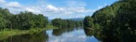
With 188 feet of climbing per mile to start, you will quickly get some great views West across Minear Run drainage to Limestone Mountain and back down the valley. Stopping to enjoy the views and taking a few picture is always a good excuse to give the legs a break. As you get nearer the top of the climb, the road switches over to the Horseshoe Run drainage, and you have wonderful vistas off to the East. You can see the windmills in the distance on Backbone Mountain. Crossing Limestone Mountain you have vistas both East and West, before returning along the edge of the Cheat River valley.
Don't let the first initial ramp out of St. George scare you. Once you round the turn, it settles down to five to seven percent. In the middle you have some flat and even a little downhill, before the final mile or so with will range between eight and 10 percent. Limestone Mountain Road is rolling with some short climbs, but overall, you are heading down hill. The final drop into the Cheat River valley is steep, so grab on to your brakes. You are basically doing in 3 miles, what you did in five miles on Location Road.
With the exception of "downtown" St. George, the whole route is on single lane county roads and none of the route has any significant traffic. As of 2025, the road surface was good to excellent. Tucker and Randolph County, because of the severe winter weather, use a lot of tar and chip sealant on their roads and that was what they used on Limestone MT. Road, new pavement with tar and chip as a sealer. Once it is worn in and the loose gravel is worked or washed off, it is an OK riding surface. If you happen to catch it right after it has been tar and chipped like I did in the late Summer of 2012, it can make for precarious riding.
I usually do this loop from camp at the Horseshoe Campground/Day Use Area, which makes it a 34 mile ride and adds another 850 feet of climbing. Bikemap.net of longer route.
Food and water sources.
There are no public food and water sources on this route.
There is a store, Patriots Four, that opened in 2013 near St. George (intersection of state routes 38 & 72) that is convenient to the bike route.
Parsons has convenience stores open 7 days a week.
Items of Interest Along the Route:
The scenery is the main item of interest along this route. Multiple vistas in all directions are provided.
Blackwater Outdoor Adventures is located in St. George. Combining this short ride with a kayak or canoe trip on the Cheat, makes a great day in the outdoors. They will take you 4 or 6 miles upstream on the flat water section, and you float back to their office. They also offer more adventurous outings on the river.
Local Sources
Nearest Bike Store: Blackwater Bikes in Davis, Tucker County.
Patriots Four has cabins for rent as well as camping.
Horseshoe Campground, a national forest campground operated by the YMCA is open June, July, and August.
Five Rivers Campground on the outskirts of Parsons.
Area Attractions
Disclaimer
The listing of routes on this site is not a guarantee of the safety of the route. Cycling has inherent risks and riders skills vary. Traffic conditions vary by time of day, season and local events. Road conditions can vary and change and may change dramatically over one winter season. Riders need to ride within their capabilities and be alert for road hazards and traffic at all times.
Copyright Notice:
This site, maps, photos and all materials created for this site are copyright of the author unless otherwise noted. They may NOT be posted on other sites or reproduced for sale or profit, without specific permission of the author. However, the maps and turn lists may be down loaded for personal, non profit use.
 Community Park is to the left of this picture.


 1
1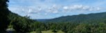 2
2 3
3 4
4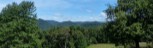 5
5 6
6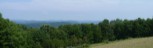 7
7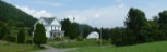 8
8 9
9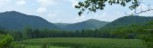 10
10