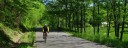
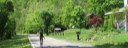
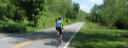
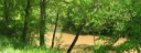
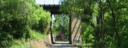
Cycling Scenic West Virginia - Milton Loop

  • Barker Ridge
  • Fudge Creek
  • County 25
  • County 25
  • Turn onto Cty 25/1 before bridge.
  • Mud River
  • CSX underpass
Barker Ridge1 Fudge Creek2 County 253 County 254 Turn onto Cty 25/1 before bridge.5 Mud River6 CSX underpass7

Milton Loop

Overview

Length: 40.6 Miles
Climbing: 2,300 Feet
Rating: 3.2
Climbing Per Mile: 57 Feet
Minimum Elevation: 581Maximum: 1011

This has been one of the Mountain State Wheelers favorite routes for years. It features one section of ridge riding (Barkers Ridge), but mostly follows streams. In addition to the climb to Barkers Ridge, there are two climbs south of US Route 50 where the route goes from one drainage area to another. Fudges Creek, Trace Creek and Mud River are some of the waterways it follows.

Location

This ride is in Eastern Milton County, between Charleston and Huntington and is bisected by Interstate 64. Directions to Start: TAKE I-64 TO MILTON. At the stop sign on the exit ramp, follow the sign to Milton. At the intersection on route 60, turn right. At the stop light, take a left and follow the road across the bridge (about 3/10 mile) and park in the areas of the ball fields. Can also start at the Milton Community Park, by taking a right at the stop light.

PDF Map and Turn List


General Description:

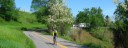
This ride features 6 miles of ridge riding along Barkers Ridge with the remainder following streams. There are three climbs. One up to Barkers Ridge, and two "huffers" South of route 60 as you go from one drainage system to another.

Milton to Ona: After a small climb leaving Milton, you follow Cty. 15 into and out of the Mill Creek drainage and at the 4.1 mile mark, you make a hard right onto Cty. 9. You have a gradual ascent for 1.5 miles and then a steep climb for the nest .5 miles to Dudley Gap where you make a left of Cty. 11 at 6.1 miles. You continue climbing at an easier gradient on Cty. 11 for 0.3 miles before topping out on Barkers Ridge. The next 6.2 miles is typical rolling ridge riding across Barkers Ridge. Elevation along the ridge varies between 900 and 1,000 feet, compared to around 600 feet for the stream valleys, At 12.3 miles you bare left onto Cty. 1 and begin the long descent from Barkers Ridge and follow Edmonds Branch to Howells Mill. Between Howells Mill and Ona you have a couple small climbs and at 20.3 miles you arrive at Ona. Be careful crossing U.S. route 60. The convience store at this location is the only public source of food and water on the route.

Ona to Milton: Continuing straight across U.S. route 60, you follow Cty. 29, ascending up Fudges Creek. You have a little bump to get over and then fairly easy ascent along Fudge Creek that gradually gets steeper as you near Susannah Church. At about 26 miles you begin a steep half mile climb, topping out at 960 feet. The descent has a couple VERY SHARP turns, so control your speed!. After the descent and a nice rollout, you make a right onto Cty. 47/1. After only 0.3 miles, you take a left onto Cty 47. One half mile after turning onto Cty 47 you begin a steep, twisting ascent of the last major climb of the day. Fortunately, this climb is only 0.3 miles long going from 700 Ft. to 850 Ft.. The descent also has a sharp turn in it, so control your speed. You have a very nice roll out along Trace Creek till you arrive at Balls Gap at 32.4 miles. Take a left onto Cty. 25, you have a little bump to go over and then you are in the valley formed by the Mud River. At 35.2 miles, you take a left before crossing the bridge and follow 25/2 along the Mud River for the next 4.5 miles, till you intersect Cty. 25 again. Taking a left on Cty. 25, you arriving back at the starting point in 0.9 miles.


Items of Interest Along the Route

Blenko Glass Company, which is located near the start of the ride, manufactures hand blown glass. Stop by the shop before or after the ride. The old Milton Covered Bridge has been reloaded to the park at the start of the ride. It is one of 17 remaining in WV and the only one using a Howe truss.


Water and Food

After leaving Milton the only source of food and water is at Ona, but it is conveniently located halfway through the ride.

Lodging

There are plenty of lodging opportunities in the area along the I-64 corridor.

Nearest Bike Shops:

Disclaimer

The listing of routes on this site is not a guarantee of the safety of the route. Cycling has inherent risks and riders skills vary. Traffic conditions vary by time of day, season and local events. Road conditions can vary and change and may change dramatically over one winter season. Riders need to ride within their capabilities and be alert for road hazards and traffic at all times.

Copyright Notice:

This site, maps, photos and all materials created for this site are copyright of the author unless otherwise noted. They may NOT be posted on other sites or reproduced for sale or profit, without specific permission of the author. However, the maps and turn lists may be down loaded for personal, non profit use.

Contact Us | ©2015 Dale Porter