


 Pee Wee


 1
1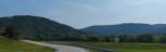 2
2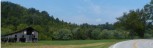 3
3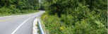 4
4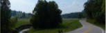 5
5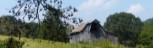 6
6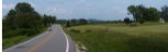 7
7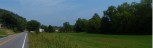 8
8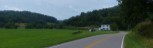 9
9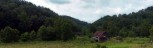 10
10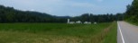 11
11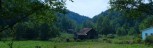 12
12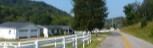 13
13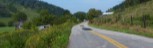 14
14General Route Description
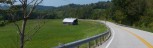
This is a flat route and there is not a major reason to ride the route in a specific direction. I like riding it counter clockwise so I'm going down grade from Sandy Summit to Palestine and I prefer going East to West on Co. 7.
New Era to Reedy - Starting at Gilmore School on route 21 in Jackson County, you take a left out of the parking lot onto Co. 21 and then left on Liverpool Road. Liverpool Road has some gentle rolls and the climb up to Sandy Summit is not bad at all. From Sandy Summit it is downgrade to Reedy. The road is in pretty good shape. There is a few pavement cracks to look out for, but overall pretty good. In Reedy is an Exxon Station and convenience store where you can get water and snacks. Last public place to top off the water bottle till Odaville, two miles from the finish.
Reedy to Palestine - Leaving Reedy, you take a left on State Route 14 heading North, down stream along Reedy Creek toward Palestine. Through the route is overall down grades, there are a couple minor grades where route 14 short cuts some big loops of Reedy Creek. You will find more traffic, but still not usually bad on route 14, but they can usually get by fairly easily. Once you pass the "Palestine" sign you still have a little ways to go before getting to the Co. 7, Garfield Road intersection.
Palestine to Odaville - Taking a left onto Co. 7, Garfield Rd. (Turkey Fork Road on the other end.) you have a gentle upgrade till you get to the bottom of the climb up to the county line. This climb starts out as 6-7% and has a 11% section near the top, but is only about 1/2 mile long. Once you cross into Jackson County, you have a nice downgrade to reward you climbing efforts and an downgrade cruise along Turkey Fork to Odaville. At the intersection with Co. 21 in Odaville is another store where you can get water and snacks. Pavement is good to fair on this section.
Odaville to New Era - Taking a left on Co. 21, you have only 2 miles back to the school in New Era, but the terrible pavement will make it seem longer. I had hopes of this section being paved in 2013, but no luck. (From Odaville North, Co. 21 has been paved in the past couple of years.) About a mile from the intersection in Odaville, off to the left on Co. 21/15 you can see the Sarvis Creek covered bridge.