Paint Creek Out and Back
Overview
From Paint Creek Exit I-77:
Length: 45.7 - Or Less - See Below
Climbing: 2,488 Feet
Rating: 3.5
Climbing per Mile: 54
Beginning Elevation: 720 Feet.
Max Elevation:
1630
Optional:
From Pratt:
Length: 60.3 - Or Less - See Below
Climbing: 2,600 Feet
Rating: 4.3
Climbing per Mile: 43
Beginning Elevation: 640 Feet.
Max Elevation:
1630
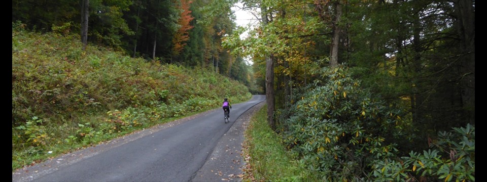
This is an out and back route, and would be considered a WV flat ride, however, there are enough ramps along the route to give your legs a workout. This ride starts at the Paint Creek Exit of I-77 and follows Paint Creek up stream to the town of Pax. The alternate longer route starts on State 61, near the Kanawha River and the town of Pratt. This is a very scenic route with views of Paint Creek. The one negative is the noise from the interstate that is often near to the route.
Being an out and back, rides of any lenght short of the total can be done. However, food and water are only available at stores in Mossy and Pax. I generally start at the Paint Creek Exit (PCE) to eliminate the traffic on the lower 6 miles of the route. From the PCE you will have minimal traffic between there and Mahan, and very little between there to the mine near Mossy.
Overview:
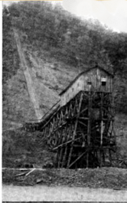
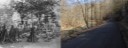
As you ride up Paint Creek, it is hard to imagine, that a 100 years ago, it was lined with houses and mines (41) along its entire length. You will ride thru ghost towns like Bedford, Detroit, Morton, Tomsburg, and Burnwell. The county highway maps still indicates the communities of Whittaker, Greencastle, Burnwell, Collinsdale, Coalfield, Milburn, and Westerly, but in some locations, not one house
Location: This ride is located in Southern Kanawha and Western Fayette Counties. It can be accessed by Interstate 77 or state route 61..
Start: The start is at the Paint Creek exit park-n-ride on I-77 (West Virginia Turnpike) - Exit 74.
Alternate start location is at the intersection of Co. 83 and State Route 61 just before entering the town of Pratt.
Getting there: From Charleston, take I-77 South to exit 74, Paint Creek Exit. Alternate: Take Chelyan exit and follow Route 61 South to junction with Co. 83, Paint Creek Road.
Ride with GPS link.
PDF Map and Turn List
General Route Description
Paint Creek Park n Ride to Mahan: This section is a slightly rolling, double lane road. After 2 miles there is a small park on the right with a pit toilet. From here, you continue gradually climbng along the East side of Paint Creek. Shortly before you reach Mahan, you will cross over Paint Creek. Mahan is small community with an exit ramp from I-77.
Mahan to Mossy: From Mahan you begin on un-striped pavement and a couple real climbs. You will pass under and over I-77 on this section. At 14.7 miles, you arrive at the only remaining active mine on Paint Creek. For the next 1.3 miles to Mossy, you need to be on the lookout for coal trucks going and coming from the WV Turnpike. The road between the mine and Mossy is wider. Arriving at Mossy, there will be a convenience store on the left. This is just past where you make a right turn onto Co. 23, which takes you to Pax. If you stop at the store, look for the picture of Elvis Presley. The owner was in the service in Germany with Elvis. Has nothing but good to say about Elvis.
Mossy to Pax: You leave Mossy on a narrow paved road, that requires vehicles to get over on the gravel berm to pass. At 28.5 miles you pass the intersection where you can go left to Plum Orchard Lake, but you want to continue straight. From this intersection, the road has been paved and widened in 2015. Arriving in Pax, you will find a convenience store. This is where you turn around.
Return: At Pax, you turn around and retrace your route to the start. Though there are a some short ascents going back, you will enjoy the overall downgrade heading back.
Items of Interest Along the Route:
Paint Creek shows little evidence of the industrail area that it was in the early part of the 20th century. The occasional glemces of the abandoned railroad are one of the few reminders. In the early part of the 20th century there were 41 mines on Paint Creek. Paint and Cabin Creeks were the site of the first mine wars in WV in 1912-13. Marshall law was declared three times, the C&O railroad, built an armored train to bring in strike breakers.
Food and Water:
There are two food and water sources along the route. One at Mossy and another at Pax.
Disclaimer
The listing of routes on this site is not a guarantee of the safety of the route. Cycling has inherent risks and riders skills vary. Traffic conditions vary by time of day, season and local events. Road conditions can vary and change and may change dramatically over one winter season. Riders need to ride within their capabilities and be alert for road hazards and traffic at all times.
Copyright Notice:
This site, maps, photos and all materials created for this site are copyright of the author unless otherwise noted. They may NOT be posted on other sites or reproduced for sale or profit, without specific permission of the author. However, the maps and turn lists may be down loaded for personal, non profit use.


 1
1 2
2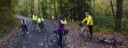 3
3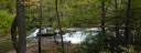 4
4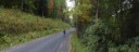 5
5