Overview
Length: 29.0
Climbing: 2,300
Rating: 2.6
Climbing:Per Miles: 79 Ft.
Min./Max. Altitude: 1854 / 2367
Location
This is a rolling ride thru the sinks area of Monroe County. You will ride by more sinks than any other area of West Virginia. Sinks Grove comes by its name honestly. There are no major climbs, but plenty of rolling terrain and some short steep ramps. The area is open farming country and the route goes by the area landmark Morgan Orchard.
PDF Map and Turn List
General Route Description
This route loops around the karst plateau in central Monroe County. With an altitude variance of only 513 feet, there are no significant climbs on the route, but the rolling terrain and a couple short steep ramps give you plenty of climbing. . The worst climb is the steep 1/10 of a mile on Route 11 to the Hillsdale-Tollgate Road that starts from a stop sign.
Through there are no major climbs, the route is far from flat, as the karst terrain is constantly rolling.
Traffic is light to moderate with the exception of 1.1 miles on U.S. 219, which it the major traffic route thru the county.
There are no stores along the route, but there is a store in Pickaway at the intersection of U.S. 219 and Rt. 3.
From start to Rt. 219. Leaving from the New Lebanon Presbyterian Church, you have 0.3 miles before making a left on Charles Boothe Rd. (219/4), a narrow country road, and immediately begin the rolling terrain that is featured on the route. After 0.8 miles, you take a right on Givens Rd. (11/1) and countinue riding thru beautiful farm county. At the end of Givens Rd. you intersect the Hillsdale Rd. (11) and you make a left and begin a very steep climb from a standing start. After only 0.1 miles you reach the top and take a right on Tollgate (219/5). This section has some nice vistas before dropping down to the intersection with 219.
219 to Sinks Grove: After making the right onto Rt. 219, you have 0.8 miles on this major route where you can expect some traffic, before taking a left on Stringtown Rd. (3/6). Stringtown is a pleasant rolling ride with some pretty farms. Taking a left at the end of Stringtown Rd. onto State Rt. 3, you have one mile to the intersection with Cty. 5 in Sinks Grove. Rt. 3 is two lane road and you can expect moderate, but not heavy traffic.
Sinks Grove to Vernon Church: Turing right off of State 3 onto Co. 5, you roll thur the small community of Sinks Grove and begin a steep little climb. You can ease this climb a little by taking Co. 5/5 which is the original road and comes back into Co. 5 3/4 of the way up the climb. Topping out the climb, the next 5 miles are overall down grade as you head toward the Greenbrier River with great views of the countryside. Just before you get to the descent to the river, you take a left onto Co. 58, Vernon Church Road and continue to descent.
Vernon Church to Sinks Grove: Just past the entrance to Vernon Church you take a left on Co. 25/1, Longanacre Road. Pavement is not the greatest on this section but passable, and you are ascending back to Sinks Grove with no fast descent. You have a rolling ascent as you travel along the foot of Flat Top Mountain. Afte 2.1 miles, you take a right onto Co. 43/2 Scott Hollow Road and continue the undulation ascent back to Sinks Grove. Nearing the end of Scott Hollow Road, you have a little climb up to the Sinks Grove Baptist Church, before taking a right on Co. 5 again and return to Sinks Groved.
Sinks Grove to Finish: Descending into Sinks Grove, you will have to brake to make the left turn onto Co. 5/3 just before Bob & Bob's store (closed I believe). The next few miles are a joy to ride. After 1.7 miles you will turn right on Neff Orchard Road and follow this to the finish. Technically, you are traveling on 3 different Co. roads, you stay on the only paved path till the intersection with Co. 219/2 where you continue straight for the last 0.4 miles to the finish.
Local Sources
Food - Water Sources: There are no stores directly on the route, however, there is a convenience store within the circle of the route at the junction of Route 3 and U.S. 219 in Pickaway,
There are a couple restaurants in Union and in Alderson.
Bike Shops - Hammer Cycle White Sulphur Springs
Items of Interest Along the Route:
The karst terrain with the numerous sinkholes (see map) is the major geographical feature of the ride.
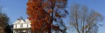
There are several beautiful old farm houses on the route..
Lodging and Camping
Monroe County Lodging
Camping is available close to the ride at Moncove Lake State Park.
Willow Bend Bed and Breakfast


 1
1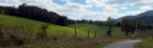 2
2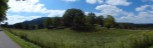 3
3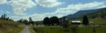 4
4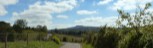 5
5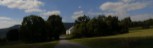 6
6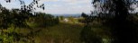 7
7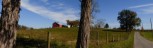 8
8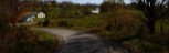 9
9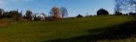 10
10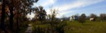 11
11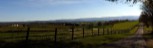 12
12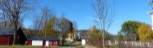 13
13