


 Looking toward Woodrow and Edray
 The Scenic Highway is on the mountain in the distance.
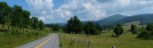 1
1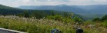 2
2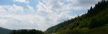 3
3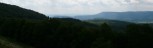 4
4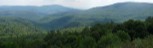 5
5 6
6 Length: 24.7
General Route Description
 This route is short but challenging. With climbs of 2 miles, 1 mile, and 3 miles in that order, it is a test of your climbing legs, and there are some rollers in between. For the climbing, you are rewarded with great vistas and a downhill that doesn't seem to end.
Edray to Highland Scenic Highway: From Edray, have a short steep climb after passing the fish hatchery, before the 2 mile winding shaded climb at Woodrow. Topping out the Woodrow climb, your enter the Williams River drainage. You ride through a beautiful farming area and are going downgrade with a few short steep ramps. Crossing the Williams River, you soon begin the one mile climb with variable pitch. Topping out the climb, you have a long downgrade to the junction with the Highland Scenic Highway.
Highland Scenic Highway to Edray: Taking a left onto the on ramp for the Scenic Highway and a right on the highway, you cross the Williams River and begin the 3 mile climb. This climb is steeper at the bottom than at the top, but is pretty consistent from top to bottom. You hope it is not a hot sunny day, as you have no shade on this climb. After reaching the overlook at the top, you have an excuse to take a break to check out the view, but you still have a little more climbing to do. After topping the last little climbing, it is all downhill. After a long downhill and passing another pull off overlook, you arrive at Rt. 219 junction. Taking a right here, you still have 3 miles of twisting, turning downhill before arriving at the finish.
I usually extend this ride by going out Co. 1, Back Mt. Rd., to Co. 16. Taking a right onto Co. 16 takes you to Co. 15, and a right on Co. 15 take you down to US 219. Taking a right on US 219 and then a left at the end of the bridge onto 219/3 at Campbelltown, takes you back to Co. 17 and the original route. When doing the extended route, I usually start at Marlin Chapel. The extended route is 33.3 miles.
Food-Water Sources:
The only public food and water sources on the route, is the convenience store in Edray at the junction of US 219 and Co. 17.