Overview
Length: 38.6
Climbing:3,225
Rating: 3.6
Climbing:Per Miles: 84 Ft.
Min./Max. Altitude:
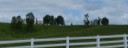
This rides covers a very scenic pastoral area of Greenbrier County. No real long climbs, but several intermediate climbs and lots of rolling terrain as can be seen on the route profile gives you a a fairly high average climb per mile. One of my favorite areas to ride in. The one problem is the lack of public sources of water in the area, as there are no stores along the route. There is a health clinic in Williamsburg, but it is only open on weekdays. It is recommended to ride in the direction indicated.
I now have three options for this route. A-38.6 miles: B-42.5 miles; and C-39.5. B adds 4 miles toward Trout and C add the Trout extension at the north end, but cuts out Herns Mill portion at the southern end of the loop.
Map and Turn List
Slideshow of Route
Ride with GPS Option A 38.6 Miles
Ride with GPS Option B 42.5 Miles
Ride with GPS Option C 39.5 Miles
General Route Description
When riding in the area, I usually start at the county courthouse, parking at the far end of the parking lot so as not to inconvenience persons with business at the courthouse. The courthouse is on Court Street, but the parking lot can be assessed from Route 219, the main North/South route thru the town. There is also a small city park off of U.S. 219 nearby that can be used.
Lewisburg to Unus Road: Heading North on Court Street, away from the downtown area, you begin some easy climbing right away. At the town limits, Court Street becomes Co. 32, Fairview Road, which is a two lane stripped highway. You have some beautiful farms and nice residential houses along this section and you quickly pass over Interstate 64 and the driveway to Lost World Caverns. At 4.4 miles, Co. 32, Fairview Road makes a 90 degree left and becomes a single lane paved road where cars have to get on the berm to pass. . (The two lane road continues straight and becomes Co. 34.). You intersection Co. 19 on a downhill section and bear right.
Unus Road to Williamsburg: Taking a right on Co. 19, which is a two lane striped road at this point, you continue heading North. After 0.5 miles at the intersection with Co. 23, you continue straight, staying on Co. 19, but it becomes a single lane, unstripped paved road. and you begin climbing toward Carroll Hill. After the descent from Carroll Hill, you take a left on Co. 17 (Williamsburg Road) at 11.0 miles in the routes namesake community of Unus. (Note the town hall at the intersection.). On Co. 17 you quickly begin one the longer climbs on the route. After topping the climb, you have some pleasant riding, and at the 13.4 mile mark, you come to the intersection with Co. 10. You bare left here to continue on the route, but going straight on Co. 10 (Trout Road) and then taking a left on Co. 9, will add a pleasant 4 miles to the route. (If taking this option, be sure to add 4 miles to all turn points on the turn list after Williamsburg.) From Co.10 intersection, you have one dip to content with, before arriving in Williamsburg.
Williamsburg to Herns Mill Covered Bridge: In Williamsburg, you take a Left on Co. 9 and then another immediate left on Co. 60/28m - Raders Valley Road.. Begin the climb over Brushy Ridge and then drop into Raders Valley. The ride down the valley is rolling, but overall downgrade. At about the 19 mile mark, you will pass the site of historic Fort Donnally. At 24.3 miles, you come to U.S. Route 60. You take a left on route US 60. Thru is is a U.S. highway and, at one time, a main East/West route thru the state, nearby Interstate 64 has taken all but local traffic off the road, so traffic is usually fairly light, but will usually be traveling at the posted 55 mph speed limit. After 2.2 miles on US 60. you bare left on Co. 60/12, Sydenstricker Lane, another single lane pave road. You shortly begin a climb that is rewarded with a great vista of the Big Levels. After the climb, you have a nice roll out and come back to US 60 after 2.4 miles. Taking a right on US60 this time you go 0.7 and take a left and then another quick left on Co. 40. There is a beautiful farm located here. On the narrow Co. 40, you will descent about 0.9 miles to the Herns Mill Covered Bridge.
Herns Mill Covered Bridge to Lewisburg: After crossing the bridge, you have a short steep climb with a sharp left turn, and the a more gentle climb along the foot of Muddy Creek Mountain with more great vistas of the Big Levels off to the left. At 32 miles, you intersect Co. 33 (the Blue Sulphur Pike) as it comes off Muddy Creek Mountain and take a left and descend for 0.6 miles before taking a right onto Co. 33/2, Rich Valley Road. After a couple rollers, you have to last real climb before coming to Co. 35, Houfnagle Road. You intersection Houfnagle Road where is makes a 90 degree turn. You take a right here and after 0.5 miles you take a left on Co.60/13 Old Powell Road. After a rolling 1.8 miles you are at the edge of Lewisburg. Take a right and then the next 90 degree turn puts you on Court Street, that you follow back to the Courthouse.
Local Sources
Nearest Bike Shops:
Hammer Cycles, White Sulphur Springs
Food - Water Sources: There are no stores directly on the route. There is a health clinic in Williamsburg, but it is only open Monday - Fridays.
There are some fine restaurants in Lewisburg.
Items of Interest Along the Route:
There are many beautiful farms along the route. Lewisburg is a charming little town with good restaurants,.and interesting shops and plenty of history to explore pre and post ride. .
The site of frontier Fort Donnally is along the route in Raders Valley.
There are several beautiful farms in the area.
Lodging and Camping
Greenbrier County Lodging and camping.
Disclaimer
The listing of routes on this site is not a guarantee of the safety of the route. Cycling has inherent risks and riders skills vary. Traffic conditions vary by time of day, season and local events. Road conditions can vary and change and may change dramatically over one winter season. Riders need to ride within their capabilities and be alert for road hazards and traffic at all times.
Copyright Notice:
This site, maps, photos and all materials created for this site are copyright of the author unless otherwise noted. They may NOT be posted on other sites or reproduced for sale or profit, without specific permission of the author. However, the maps and turn lists may be down loaded for personal, non profit use.


 1
1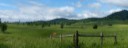 2
2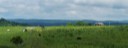 3
3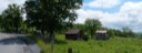 4
4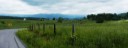 5
5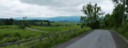 6
6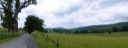 7
7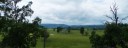 8
8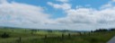 9
9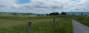 10
10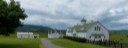 11
11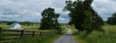 12
12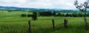 13
13