


 1
1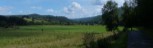 2
2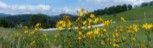 3
3 4
4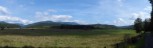 5
5 6
6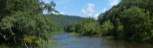 7
7 8
8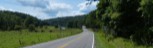 9
9 10
10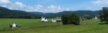 11
11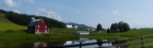 12
12General Route Description
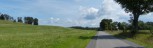
From Marlinton to Route 28, you are following along the foothills of the mountains, which gives you a rolling terrain with lots of climbing. Route 28 is in the valley and the Dilley Mill Road portion is aling the ridge before descending back to Route 28.
From Huntersville to Edray: Leaving from the junction of Rt. 28 and Rt. 39, you take Rt. 38 toward Marlinton. Rt. 28 follows Knapps Creek to Marlinton. This is a flat ride into Marlinton with just one rise before descending into Marlinton. This is the section of the ride you are most likely to encounter traffic, so it is nice to get it out of the way when you are fresh. In Marlinton, proceed thru downtown and across the Greenbrier River. At the end of the bridge,take a left onto US 219, and the next right onto Jericho Road. Jericho Rd. is a narrow country road with several short steep ramps and twisting down hills. Passing the old log chapel you bare left and climb up to Woodrow Road where you take a right and descend down past the fish hatchery before climbing back up to US 219. There is a convenience store at this intersection.
Optional Routing: Arriving at the junction of routes 39 and 219, you take a right and follow 219 till you cross a bridge and take an immediate left onto Co. 219/3 Stoney Creek Road. You follow the road till it intersects with Jericho Road, the main route, and go right on the main route
Edray to Clover Lick: Leaving the convenience store you head north on US219, taking the first right past the church onto Co. 1, Edway Road. Edray Road is narrow and you need to be aware of oncoming traffic and possible gravel on the road, especially in the turns. Co. 1 is rolling terrain with some short steep ascents and descents, but overall climbing until you come to "The Loop" (refer to PDF map). The Loop section is always a really FUN section to roll through. You will have some more rolling terrain before 1/2 mile descent to the Clover Lick Valley. Coming to the bottom of the descent thru the woods, you arrive at the open fields of the Clover Lick Valley. This is a beautiful valley which was once the course of the Greenbrier River, before the meander was cut thru forming the Clover Lick Oxbow. Clover Lick is where the short and long routes split.
Optional Routing: You can take a left on Beverage Road before dropping down to Clover Lick and skirt the upper and far end of the valley before arrriving at Clover Lick. This became available in 2024 with paving of Beverage Road. This option is two miles longer and adds 309 feet of climbing.
Clover Lick to Seneca State Forest Office: This section begins with a 4.1 mile climb thru a forest before a short steep descent down to the intersection with Route 28. A lot of this section is thru a portion of Seneca State Forest. Control your speed on the descent as there is a stop sign at the bottom. Turing right onto route 28, you climb gradually up thru Seneca State Forest past the campground. You then start to descent before arriving at the office.
Behind the office is a shower facility and there is a faucet low down in the side of the building from which you can get fill you water bottles.
Seneca State Forest Office to Huntersville: Leaving the office you go down Route 28 a short distances and turn left on the Co. 13 just past the football fields and begin climbing up to the ridge that separates routes 28 and 92. Reaching the top of the ridge, you turn right onto route 13/1 Gordon Dilley Road. This route follow the ridge for about 4 miles with some descents and climbs and some great vistas before descending back to route 28. From the intersection you continue to descend most of the way back to Huntersville, with only a couple rises to interrupt a pleasant cruise to Huntersville.
Food-Water Sources:There are stores in Marlinton, and a convenience store in Edray. You will want to be sure to top off your water bottles in Edray, as there are no other sources until Seneca State Forest. Water can be obtained at Seneca State Forest from a faucet on the side of the building behind the office.