


 Tucker Cty. 1
 Tucker Cty. 1

 1
1 2
2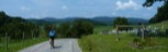 3
3 4
4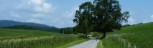 5
5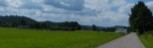 6
6 7
7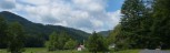 8
8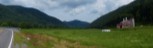 9
9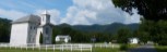 10
10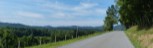 11
11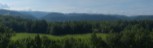 12
12 13
13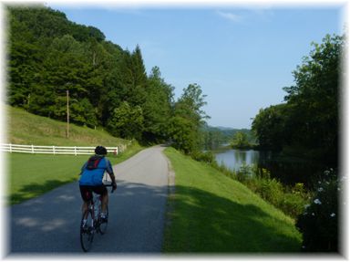 Length: 55.9 Miles
General Route Description
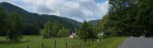
Elkins to St/ Geprge: Starting at the southern trail head of the Allegheny Highlands Trail head, you head north on the trail, the old Western Maryland Railway route to Davis. You follow Leading Creek and at 4.1 miles you arrive at route 219/89 (old route US 219). You take a left on 219/86, go 0.15 miles and take a right on County 1, Leading Creek Rd. (shortly called Gilman Road). Co. 1 follows Leading Creek, north out of Elkins and provides a flat ride to warm up the legs. At 6.8 miles you make a sharp right (road enters from left), before taking a left on Co. 3/3 and continuing up the valley. At 11.2 miles, what appears to be the main route goes right, but you go straight to continue on Co. 1. After another 1.2 miles you continue straight at the stop sign. At 14.2 miles you begin the climb up to the county line at 14.3 miles. The climb has some ramps in excess of 10%. At the top, the road becomes Tucker Co. 23.
Reaching the top of the climb and the unmarked county line, you begin a nice descent. You have an immediate U turn and another sharp turn on the descent, but overall, it is a very pleasant descent that goes all the way to the intersection with County 21 at 16.4 miles. Taking a right on Co. 21, you still are still going downgrade along Clover Run. At 19.1 miles you come to the intersection with Co. 17, which comes over the mountain from Parsons. You bare left to continue on Co. 21 and at 21.6 miles you cross an open grid medal deck bridge just before arriving at the intersection with State Route 38. Taking a right on 38, you have a 1.2 mile gradual downhill run to Route 72 and the Cheat River. Taking a right on 72, you go 0.4 miles and take a left across the Cheat River to St. George.
St. George to Parsons:
Take a right in St. George on route 1 and past the St. George Academy and the St. George Medical Clinic. The clinic is a good place to top off the water bottles for the final trip to Parsons (access is restricted in 2020 because of the virus.). There is a water dispenser in the waiting room where you can get water. Passing the clinic, you will be traveling along the edge of the Cheat River valley with rolling terrain and a couple short steep ramps. After passing the roads to Horseshoe Campground and Sugarland Road you will come to a sharp switchback that begins a decent climb. This is a pretty steady climb with no severe ramps. Topping out, you begin a steep descent with a sharp turn in the middle. Look for rocks in the road near the bottom.
Reaching the bottom, you come out again along a short beautiful stretch of Cheat River. Leaving the river as it goes to the other side of the valley you have some more short steep rollers before crossing the river again and coming back to route 72. Take a left on route 72, cross over Corridor H and have a short steep decent and cruise into Parsons. When arriving in Parsons, I cut left toward the Five Rivers Campground and take the back streets toward the courthouse to avoid the Route 72 - US 219 intersection.
Parsons to U.S. 219. Starting at the Allegheny Highland Rail Trail parking behind the old train station behind the convenience store across from the courthouse, you head South toward Elkins on the trail. Watchout for some root bumps on the rail trail. You soon arrive at the Corricks Ford Battlefield site. You will want to take the time to read the interpretive signs. Past the Corricks Ford site, you come to the Kingsford Charcoal Plant. with its huge pile of wood chips. I've always loved the smell of wood chips. Be cautious of trucks entering and leaving the plant. Continuing on the trail you will arrive at Porterwood, where a there is a kiosk and more trail parking. You will come alongside County 39 on your left. At the kiosk, you will do a 180 degree turn onto route 39, which leads you up Shavers Fork of Cheat. This is the route the Confederate Army took to Corricks Ford. The road here skirts the valley along the edge of the mountain with numerous rollers. 2.4 miles from Porterwood, the road make a sharp downhill right turn and comes to an intersection. Route 39 continues up river to the left and County 47 comes in from straight ahead. You want to continue straight onto route 47 past Irons Chapel.
Two miles on route 47 along Pleasant Run brings you to the 1.6 mile climb to the county line at the summit of Cheat Mountain. At the summit, Tucker Co. 47 becomes Randolph Co. 3. You descent from the summit on Co. 3 to the intersection of U.S. 219. You will pass under Corridor H on this section and arrive at U.S. 219.
U.S. 219 to Elkins: Continuing straight across U.S 219 you take a left on Co. 3/3 and head south toward Elkins past some beautiful farms. Taking a right on Co. 7 at the Isner Farm and you soon complete the loop and begin to back track your previous route to Elkins. You have a relatively flat trip back to Elkins.