


")


 1
1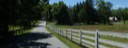 2
2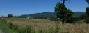 3
3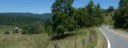 4
4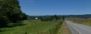 5
5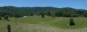 6
6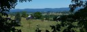 7
7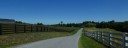 8
8 9
9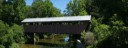 10
10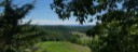 11
11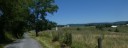 12
12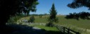 13
13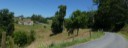 14
14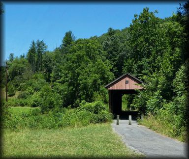
General Description
This is a very scenic route and though not a long route, climbing in and out of the Greenbrier drainage three times provides plenty of challenge for those climbing legs.
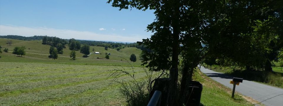
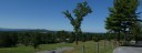
Leaving Lewisburg on the rolling plains of the Big Levels, you soon drop down to the Greenbrier River and then climb out again at Fort Springs, the first of three big climbs on the route. You then enjoy the beautiful rolling farm land of southern Greenbrier and northern Monroe County. You then drop down to Second Creek and the Hokes Mill covered bridge and then climb to skirt along the highlands along the Greenbrier River. After enjoying some great vistas, you drop down to the Greenbrier River again at Ronceverte. From Ronceverte you have a long and sometimes steep climb topping out on the ridge overlooking Lewisburg and then descent to Lewisburg and the finish.
In addition to the basic route, a glance at the map will show there are some options to the listed route to add a little variety when riding in the area:
- Staying on Co. 43, rather than Co. 56/1 and 5/2 keeps you along the escarpment to Second Creek. Very scenic, but adds some shorter steep ascents.
- Leaving Hokes Mill, you have the option of taking Co. 48, River Road into Ronceverte. This eliminates a lot of climbing and gives a rather flat ride to Ronceverte. .
- Staying on Co. 62 and then taking Co. 65 to U.S. 219 is another option for getting to Ronceverte.
Route Description
Start:
The route starts at the Greenbrier County Courthouse in Lewisburg. I generally park in the courthouse parking lot.
Lewisburg to Fort Spring: From in front of the court house, you head downtown on Court Street. After crossing the main drag (route 60) I go up one street to Church Street and take is out of town. Church Street makes a 90 degree left at the edge of town and then you take the next right onto Old Powell Road. You follow the rolling Old Powell Road for a couple miles before making a right on Co. 37, Davis Stuart Road and have a short steep climb and then more rolling pastoral terrain. At 6.1 miles you make a right on State 63 and begin a 1.6 mile descent down to the Greenbrier River. AT the bottom of the descent (7.7 miles) you turn left on Co. 43 and you have a flat cruise along the Greenbrier River. At the end of the bridge over the Greenbrier, you take a left and arrive at Fort Spring.
Fort Spring to Sinks Grove: Arriving at Fort Spring, you begin the first long climb of the ride, as Co. 43 makes a sharp right climbing turn. The mile climb is a pretty consistent 6-8% grade along the edge of what used to be an oxbow of the Greenbrier River. After topping out the climb, you take the first right onto Co. 56. Co. 56 is a single lane paved road. After descending a mile you make a left onto Co. 56/1 just past the church. (You do not want to miss this turn.) Co. 56/1, Longanacre Road, has the poorest pavement on the route and you begin a rolling ascend up Scott Hollow. This road follows along the base of Flat Top Mountain to the West. Shortly after baring right at the intersection with Co. 43/2 you cross from Greenbrier to Monroe County and 56/1 becomes Co. 5/2. At the intersection with Co. 5, you take a right just before entering the community of Sinks Grove.
Sinks Grove to Hokes Mill: You enter on a short steep downhill and make a left on Co. 5/3.( If you reach route 3, you have gone to far.) Co.. 5/3 is another narrow paved road. Riding out 5/3 thru farm land you pass a couple intersecting roads and have a little ascent with nice views to the right. Topping out the climb, you begin a steep, twisting descent to Second Creek.. You cross Second Creek on a new bridge, passing from Monroe,County back to Greenbrier County again. The renovated Hokes Mill covered bridge is to the right of the new bridge.
Hokes Mill to Ronceverte: Shortly after passing the bridge, you begin a long climb out of the drainage to the ridge above the Greenbrier River. Co. 62/1 goes to the left and is a pleasant little out and back to the Greenbrier River, if you want to add a couple miles. After 1.2 miles of the climb, county 48, River Road goes left. This provides a shorter and much easier route to Ronseverte as it drops down and follows the river to Ronceverte, but you miss some great vistas. Continuing on Co. 62, you have another half mile before topping out the climb. After this long climb, you climbing is not done as the next 3.4 miles is up and down, but overall up, but you are rewarded with some great vistas off to the right. Co. 62 will make a 90 degree right at the intersection with Co. 56 along this section. You continue straight at this intersection onto Co. 56.You proceed 1.4 miles past this intersection before the long steep descent down to the Greenbrier River and the intersection with Co. 48, River Road. Turning right on River Road, you shortly arrive at U.S. 219. You turn right on 219 and cross the Greenbrier River and enter Ronceverte.
Ronceverte to Lewisburg: Entering Ronceverte, you take a right off of 219 down to Edgar Street, and follow Edgar Street past the train station and continue on Edgar Street (Co. 45) out of town. Once leaving town you begin climbing. The climbing is fairly easy at first but as you near Lewisburg, it becomes steeper. The last 0.9 miles of the climb is challenging before topping out. Dropping down to the outskirts of Lewisburg, you take a right on Holt Lane to avoid the traffic on U.S 219. Continue on Holt Street and then take a right on E. Foster Street. Cross 219 at the light and then take a right on Court Street and proceed back to the finish at the court house.