 Pocahontas County is a well known destination for the outdoor enthusiast with a wide variety of recreational activities. The road riding opportunities are outstanding in this county. What I consider the best cycling road in the state, Pocahontas Co. #1 runs for 33 miles from Durban to Edray. Marlinton, the county seat, offers dining and lodging facilities.
- Population: 7,653 (2024 Est.)
- Pop. Per Sq.: 8.1
A little about the county.
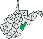
 Pocahontas County
is the third largest county in West Virginia by area and at 8.1 persons per square mile, has the lowest population density. It is an elongated county with a length of about 53 miles from NE to SW. The Greenbrier River bisects the county from is sources on the northern boundary to where it exits the county on the southern border South of Denmar. The first known white settlers were Jacob Marlin and Stephen Sewell in 1740. Real development did not begin until the C&O Railroad built the rail line up the Greenbrier River to Durbin, to tap the rich forest resources of the area. Henry Gassaway Davis later built the Coal and Iron Railroad (later Western Maryland) form Elkins to Durbin With the exception of fourteen miles between Cass and Durbin, all the railroad mileage has been converted to rail trails. The West Fort Rail trail between Durbin and Glady is my favorite in the state.
Pocahontas County
is the third largest county in West Virginia by area and at 8.1 persons per square mile, has the lowest population density. It is an elongated county with a length of about 53 miles from NE to SW. The Greenbrier River bisects the county from is sources on the northern boundary to where it exits the county on the southern border South of Denmar. The first known white settlers were Jacob Marlin and Stephen Sewell in 1740. Real development did not begin until the C&O Railroad built the rail line up the Greenbrier River to Durbin, to tap the rich forest resources of the area. Henry Gassaway Davis later built the Coal and Iron Railroad (later Western Maryland) form Elkins to Durbin With the exception of fourteen miles between Cass and Durbin, all the railroad mileage has been converted to rail trails. The West Fort Rail trail between Durbin and Glady is my favorite in the state.
Local Sources
Nearest Bike Shops:
The The Dirt Bean bike shop and cafe. 818 Second Avenue, Marlinton not sells and services bikes, but offers good food, smoothies, and deserts.
Greenbrier Bike 926 3rd Ave. Marlinton is a full service bike shop.
Disclaimer
The listing of routes on this site is not a guarantee of the safety of the route. Cycling has inherent risks and riders skills vary. Traffic conditions vary by time of day, season and local events. Road conditions can vary and change and may change dramatically over one winter season. Riders need to ride within their capabilities and be alert for road hazards and traffic at all times.
Copyright Notice:
This site, maps, photos and all materials created for this site are copyright of the author unless otherwise noted. They may NOT be posted on other sites or reproduced for sale or profit, without specific permission of the author. However, the maps and turn lists may be down loaded for personal, non profit use.


 1
1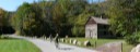 2
2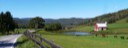 3
3 4
4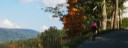 5
5 6
6 7
7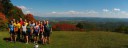 8
8 9
9 10
10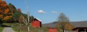 11
11
